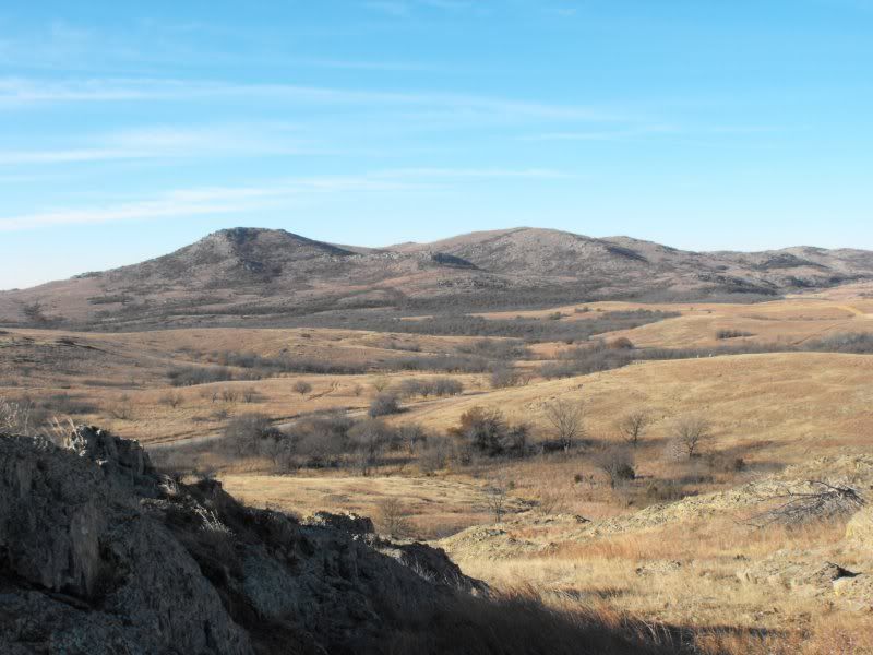
The range was really beautiful in the afternoon. To the west of our starting point in the Wichita Hills was Rabbit Hill, a rocky granite outcropping with a great view from the peak. I regretted not bringing my camera.
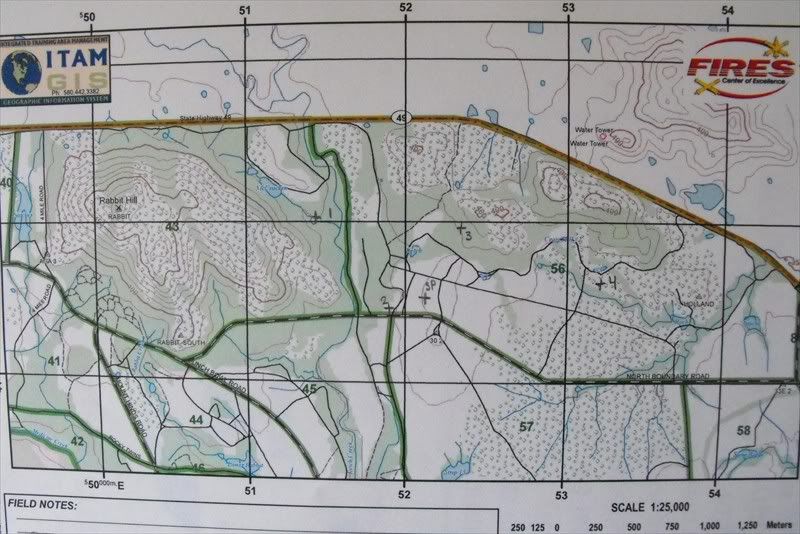
(This was someone else's map. Everyone had different points.)
On Tuesday, we had the land nav test. Up at 3:00am, we we shipped out and started the course at 0500. It was mighty cold that morning, moreso because I decided against wearing my long sleeve insulator ("PolyPro"). Though it warmed up later and I knew I'd be OK once I started moving, it was small consolation as I was sprawled out on the ground with a clipboard, plotting points on my paper. My hands were shaking in spite of the gloves I had brought.
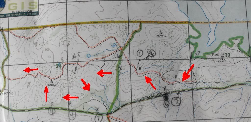
We had about 15 minutes to plot our points before starting off to find five out of eight points in five hours. My two closest points were to the southwest over a small ridge, so I took it slowly to let my eyes adjust. Unlike Benning, we weren't allowed to use our red-lens flashlights except to look at our map, which was a distinct disadvantage. It took me two hours to get both of them. Here's a map of the course we did. I generally followed the red arrows west from the lake.
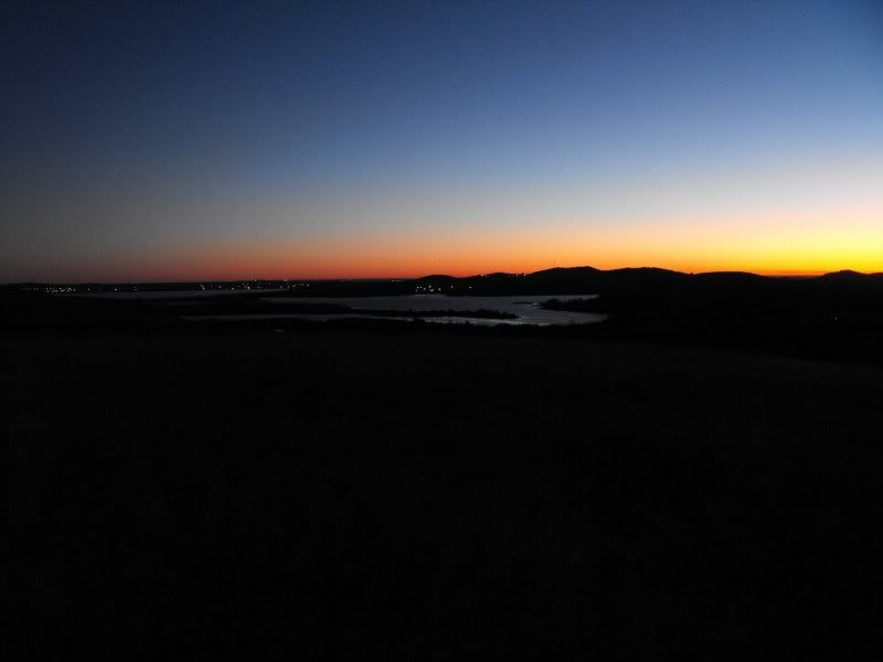
By the time I'd gotten half-way to the next point on top of a hill, the sun was coming up over Lake Elmer Thomas, so I sat down to ate my breakfast and watch the sun rise.
After about 10 minutes, sun sunshine and sparse trees made it a piece of cake to find my third point. My fourth point was easy to find, too -- I didn't even need to plot azimuths or calculate distance -- I just used terrain association. Points five and six were similar.
I then turned southeast to get point six, which took me longer than it should have -- it was in the middle of a clearing near a creek. Once I found it, though, points seven and eight were easy to find; they were pretty much due west from #6.
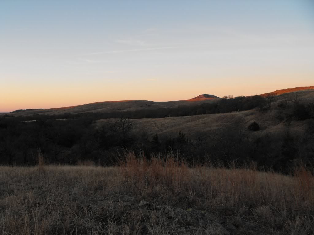
I had about 45 minutes to make it to the finish point, so I decided to go to the top of the hill to the north and take another picture or two before heading in.
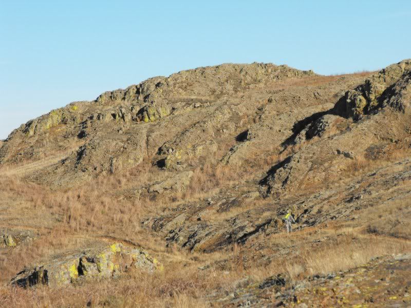
[See the person in the second picture's bottom right?]
Once I hit the fire break on top of the hill, I turned west toward the finish point, and got there with twenty minutes left.
Overall, I thought the course was fairly easy, but there were a number of people who messed it up for various reasons, including one of my roommates. Maybe I was just lucky with my points.... In any case, land nav is finished, unfortunately. I almost wish I had failed, just so I could do it again.

No comments:
Post a Comment